
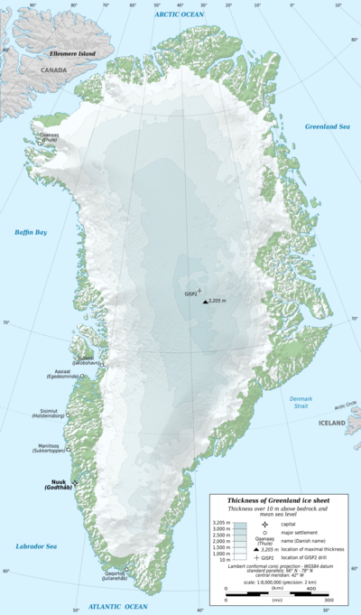
The Greenland Ice Sheet, covering 1.7 million km² and holding about 10 % of Earth’s freshwater, is a critical climate indicator whose melting influences sea level, weather patterns, and ecosystems worldwide.
Quick Answer
The Greenland Ice Sheet is a massive, continent‑scale body of glacial ice that sits atop the island of Greenland. It grows by snowfall and loses mass through surface melt, iceberg calving, and basal sliding. Scientific assessments, especially the Intergovernmental Panel on Climate Change (IPCC) reports, show that warming temperatures and ocean heat are accelerating mass loss, contributing roughly 0.7 mm per year to global sea‑level rise. While the sheet will not disappear within a single decade, continued warming could raise sea level by up to 7 m if fully melted, a scenario with high uncertainty but strong evidence of long‑term risk.
Key Takeaways
- The ice sheet stores ~2.9 million km³ of freshwater, enough to raise global sea level by more than seven metres if fully lost.
- Surface melt and iceberg calving have accelerated since the 1990s, driven mainly by atmospheric warming and increased ocean heat.
- Ice‑core records provide a continuous climate archive spanning over a million years, informing future projections.
- Albedo feedback, meltwater lubrication, and subglacial hydrology amplify ice‑sheet instability.
- Mitigation of greenhouse‑gas emissions, improved monitoring, and adaptive coastal planning are essential to limit future impacts.
What Is The Greenland Ice Sheet?
The Greenland Ice Sheet (GIS) is a dome‑shaped mass of ice that covers roughly 80 % of Greenland’s land area. It is distinct from smaller mountain glaciers and ice caps that dot the island. The sheet’s thickness exceeds 3 km in the interior, thinning toward the margins where outlet glaciers discharge ice into the ocean. Because of its size and elevation, the GIS acts as a long‑term reservoir of freshwater and a sensitive barometer of climate change.
How Does the Greenland Ice Sheet Work?
Ice Accumulation and Compaction
Snowfall adds fresh water to the surface each year. Over decades, the weight of overlying snow compresses lower layers into dense glacial ice, a process recorded in annual layers that become ice‑core archives. The accumulation‑ablation balance (net gain minus net loss) determines whether the sheet grows or shrinks.
Ice Flow and Basal Sliding
Gravity drives ice flow outward from the high interior toward the coast. In the deep interior, deformation of the ice crystals dominates movement. Near the margins, meltwater that reaches the base acts as a lubricant, enabling basal sliding—a faster, sometimes episodic, flow that can accelerate discharge of icebergs.
Surface Melt and Runoff
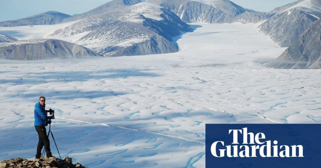
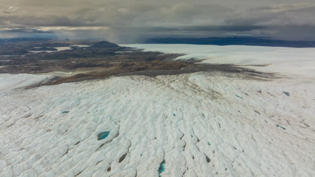
During summer, solar radiation and warm air melt surface snow, forming meltwater ponds. When these ponds drain, they can percolate to the bed, enhancing basal sliding. Meltwater also runs off into the ocean, directly contributing to sea‑level rise.
What Does the Evidence Show?
Satellite altimetry (e.g., NASA’s ICESat‑2) and gravimetry (e.g., ESA’s GRACE mission) have measured a net loss of about 3,800 km³ of ice per year between 2003 and 2020, according to the IPCC Sixth Assessment Report (2021). Ground‑based observations confirm that outlet glaciers such as Jakobshavn Isbræ have sped up by up to 70 % since the 1990s. Ice‑core analyses from the NEEM and GRIP sites reveal that the current rate of warming exceeds any natural variability in the past 800 years.
Main Causes or Drivers
Atmospheric Warming
Average Arctic air temperatures have risen at more than twice the global rate, a phenomenon known as Arctic amplification. Warmer air increases surface melt and lengthens the melt season, directly reducing mass balance.
Oceanic Heat Transfer
Warmer Atlantic waters intrude beneath the ice‑sheet margin, melting glacier fronts from below. Observations from autonomous underwater vehicles indicate that ocean‑driven melting accounts for roughly one‑third of total mass loss.
Feedback Processes
Reduced surface albedo (reflectivity) as snow melts exposes darker ice or rock, absorbing more solar energy and further accelerating melt. Meltwater that reaches the bed lubricates flow, creating a positive feedback loop that can trigger rapid glacier acceleration.
Environmental and Human Impacts
Environmental Impacts
Accelerated ice loss contributes to global sea‑level rise, threatening low‑lying coastal ecosystems such as mangroves and tidal wetlands. Freshwater input alters North Atlantic salinity, potentially influencing the Atlantic Meridional Overturning Circulation, a key component of Earth’s climate system.
Human Impacts
Rising seas increase flood risk for coastal cities worldwide, endangering infrastructure, housing, and livelihoods. Small island nations face heightened displacement pressures, while agricultural regions may experience salt‑water intrusion into groundwater supplies.
Regional Differences
Mass loss is not uniform across the sheet. The western sector, where warm Atlantic waters interact with outlet glaciers, shows the greatest thinning, whereas the eastern interior remains relatively stable. Monitoring networks in Greenland’s Nuuk and Kangerlussuaq regions provide high‑resolution data that capture these spatial variations.
What Scientists Know With High Confidence
- The GIS is losing mass at an accelerating rate, confirmed by multiple independent satellite records.
- Atmospheric warming and oceanic heat are the primary drivers of recent melt acceleration.
- Ice‑core records reliably reconstruct past temperature and atmospheric composition over the last 800 years.
- If the sheet were to melt completely, global sea level would rise by more than seven metres.
What Remains Uncertain
Key uncertainties include the exact threshold at which meltwater‑driven basal sliding could trigger a rapid, irreversible retreat of major outlet glaciers, and how future ocean circulation changes will interact with ice‑sheet dynamics. Improving subglacial hydrology models and expanding autonomous sensor networks are priorities for reducing these gaps.
Common Misconceptions
Misconception: The Greenland Ice Sheet will disappear within the next decade.
Reality: Current observations suggest a multi‑century timescale for complete loss under high‑emission scenarios; rapid melt may occur in parts of the sheet, but total disappearance this decade is inconsistent with scientific evidence.
Misconception: All meltwater directly raises sea level.
Reality: Some meltwater refreezes within the ice sheet or is stored in subglacial lakes, delaying its contribution to sea level.
Misconception: The ice sheet is isolated from the rest of the climate system.
Reality: The GIS interacts with atmospheric circulation, ocean currents, and even global carbon cycles through its influence on albedo and freshwater fluxes.
Solutions and Limitations
Mitigation strategies focus on reducing greenhouse‑gas emissions to limit further warming; this addresses the primary driver of melt. Adaptation includes enhanced coastal defenses, managed retreat, and early‑warning systems for storm surges. Scientific solutions such as geo‑engineering (e.g., surface albedo enhancement) remain experimental, with uncertain side effects and governance challenges. Continued investment in satellite monitoring, autonomous drones, and international data sharing improves predictive capacity but does not replace the need for emissions cuts.
What Individuals, Communities, and Governments Can Do
What Individuals Can Do
Support policies that price carbon, reduce personal energy consumption, and choose low‑carbon transportation options. Engaging in local climate‑action groups can amplify community resilience planning.
What Communities and Organizations Can Do
Implement climate‑smart land‑use planning, protect coastal wetlands that buffer sea‑level rise, and invest in renewable energy infrastructure. Sharing local observations with scientific networks enhances data coverage.
What Governments Can Do
Adopt ambitious emissions‑reduction targets consistent with the Paris Agreement, fund long‑term ice‑sheet monitoring programs, and develop integrated coastal zone management that incorporates sea‑level projections from GIS studies.
Synthesis
The Greenland Ice Sheet is a massive, climate‑sensitive reservoir of freshwater whose ongoing loss signals a warming world. Robust evidence links atmospheric and oceanic warming to accelerated melt, while feedbacks such as albedo loss and basal lubrication amplify change. High‑confidence findings confirm rising contributions to sea level and broader climate impacts. Remaining uncertainties center on the speed of dynamic ice‑sheet responses and future ocean conditions. Effective responses combine rapid greenhouse‑gas mitigation, resilient coastal adaptation, and sustained scientific observation, acknowledging that individual actions are important but must be part of coordinated, systemic change.
Frequently Asked Questions
What defines the Greenland Ice Sheet and how is it different from other glaciers?
The Greenland Ice Sheet is a continent‑scale body of ice covering about 80 % of Greenland, up to 3 km thick, whereas glaciers are smaller, flow‑type ice masses that originate from mountain ranges or ice caps.
How does surface melt contribute to sea‑level rise from the Greenland Ice Sheet?
Surface melt creates meltwater that can flow directly into the ocean or reach the ice base, enhancing basal sliding; both pathways add freshwater to the sea, raising global sea level.
What are the main drivers behind the recent acceleration of Greenland Ice Sheet loss?
The primary drivers are Arctic atmospheric warming, which lengthens the melt season, and increased oceanic heat that melts glacier fronts from below, together amplifying ice loss.
Why is the Greenland Ice Sheet considered a high‑confidence indicator of climate change?
Multiple independent satellite records, ice‑core data, and field observations consistently show accelerating mass loss linked to rising temperatures, giving scientists strong confidence in its role as a climate indicator.
What actions can governments take to mitigate the impacts of Greenland Ice Sheet melt?
Governments can set ambitious emissions‑reduction targets, fund long‑term ice‑sheet monitoring, and develop integrated coastal management plans that incorporate projected sea‑level rise from Greenland melt.





Leave a Comment