
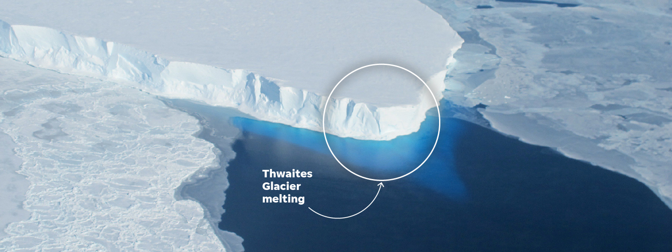
Thwaites Glacier, often called the “Doomsday Glacier,” is a massive West Antarctic ice stream whose accelerated melting could add up to three metres of sea‑level rise, threatening coastal communities worldwide.
Quick Answer
Thwaites Glacier is a roughly 100‑kilometre‑long ice stream in West Antarctica that acts as a keystone for the surrounding ice sheet. Warmer ocean waters erode its base while rising air temperatures increase surface melt, destabilising the glacier’s grounding line. Scientific assessments indicate that complete loss of Thwaites could raise global sea level by up to three metres, a change that would reshape coastlines and displace millions. However, uncertainties remain regarding the exact timing of collapse and the extent of downstream glacier interactions.
Key Takeaways
- Thwaites Glacier holds enough ice to raise sea level by about three metres if fully melted.
- Ocean‑driven basal melting and atmospheric surface melt are the primary drivers of its acceleration.
- Loss of Thwaites could trigger a cascade, destabilising neighboring glaciers in the West Antarctic Ice Sheet.
- High‑confidence findings include rapid basal melt rates and the glacier’s role as a buttress for inland ice.
- Key uncertainties involve the timing of a potential full collapse and the response of adjacent ice streams.
What Is Antarctica’s Doomsday Glacier: Why Thwaites Threatens Global Stability?
Thwaites Glacier, located in the Amundsen Sea sector of West Antarctica, spans roughly 100 km in length and 20 km in width—an area comparable to the U.S. state of Florida. It feeds the larger West Antarctic Ice Sheet (WAIS) and acts as a buttress that slows the flow of ice from the interior toward the ocean. The term “Doomsday Glacier” reflects scientific concern about its potential to cause rapid sea‑level rise, not sensationalism. Understanding Thwaites is essential because its stability directly influences global coastal risk.
How Does It Work?
1. Ice Flow and Grounding Line Dynamics
Ice from the Antarctic interior travels downhill under gravity. At the grounding line—where the ice sheet lifts off the bedrock and begins to float—basal friction drops dramatically, allowing ice to accelerate. Thwaites sits on a downward‑sloping seabed that deepens inland, making its grounding line especially vulnerable to oceanic warming.
2. Basal Melting by Warm Ocean Water
Southern Ocean currents transport relatively warm, salty water onto the continental shelf. When this water reaches the glacier’s base, it melts ice from below at rates measured by satellite altimetry and submarine surveys. The Intergovernmental Panel on Climate Change (IPCC) AR6 (2021) reports basal melt rates of up to 30 m per year in the Thwaites sector.
3. Surface Melt and Ice Shelf Thinning
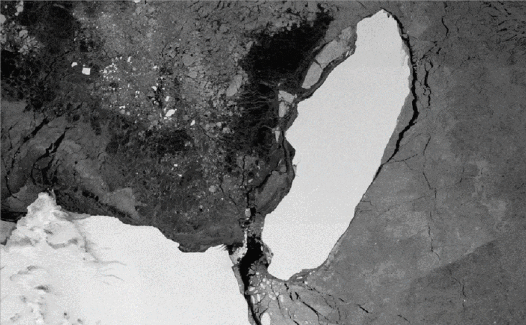
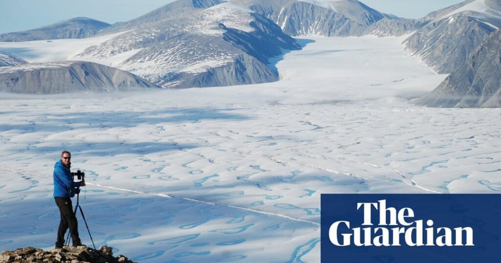
Higher atmospheric temperatures increase surface melt and the formation of melt ponds, which can penetrate cracks and promote iceberg calving. Remote sensing by NASA’s MODIS instrument shows a steady increase in surface melt days over the past two decades.
4. Feedback Loops
As basal melt thins the ice shelf, the buttressing effect weakens, allowing faster ice discharge from the interior. Faster flow brings more warm water into contact with the grounding line, amplifying melt—a positive feedback that can lead to rapid destabilisation.
What Does the Evidence Show?
Multiple lines of evidence converge on the conclusion that Thwaites is accelerating:
- Satellite observations (e.g., ESA’s CryoSat‑2) record a 4‑5 % per year increase in ice‑flow speed since the early 2000s.
- Sub‑marine measurements from the International Thwaites Glacier Collaboration (ITGC) reveal basal melt rates exceeding 20 m per year in some sectors.
- Ice‑sheet modelling (e.g., the Ice Sheet System Model, ISSM) consistently projects that continued warming could lead to a total loss of the glacier’s ice within centuries.
- Paleoclimatic reconstructions indicate that past warm intervals (e.g., the last interglacial) corresponded with higher sea levels, supporting the link between Thwaites melt and global sea‑level change.
These observations are corroborated by assessments from the IPCC and the National Snow and Ice Data Center, providing strong confidence in the observed trends.
Main Causes or Drivers
Direct Causes
- Warmer circumpolar deep water reaching the glacier’s grounding line.
- Increasing atmospheric temperatures that raise surface melt rates.
Underlying Drivers
- Global greenhouse‑gas emissions driving oceanic and atmospheric warming.
- Changes in wind patterns that alter the delivery of warm water onto the continental shelf.
Amplifying Factors
- Sub‑glacial topography that slopes downward inland, predisposing the grounding line to retreat.
- Loss of sea‑ice cover, which reduces the insulating barrier between the ocean and the ice shelf.
Environmental and Human Impacts
Environmental Impacts
Complete loss of Thwaites would contribute up to three metres of global sea‑level rise, reshaping coastlines, eroding habitats such as mangroves and tidal marshes, and increasing ocean‑acidification through altered circulation patterns. The added freshwater could also modify Atlantic Meridional Overturning Circulation, with broader climate implications.
Human Health and Social Impacts
Rising seas threaten low‑lying urban areas, leading to increased flood risk, salt‑water intrusion into freshwater aquifers, and heightened exposure to water‑borne diseases. Displacement of populations could create climate‑refugee flows, straining social services and public health systems, especially in vulnerable developing nations.
Economic and Infrastructure Impacts
Coastal infrastructure—including ports, power plants, and transportation networks—faces heightened exposure. The World Bank estimates that a one‑metre sea‑level rise could cost global economies upwards of $1 trillion per year in adaptation and loss mitigation; three metres would amplify these costs dramatically.
Regional Differences
The magnitude of impact varies by region. Small island nations such as the Maldives could see entire land loss, whereas densely populated deltas in South and Southeast Asia (e.g., the Mekong, Ganges‑Brahmaputra) would experience severe inundation and agricultural disruption. In contrast, higher‑latitude coasts like Scandinavia may see slower shoreline change but still confront infrastructure adaptation challenges.
What Scientists Know With High Confidence
- Thwaites Glacier is losing mass at an accelerating rate, driven primarily by basal melting.
- The glacier’s grounding line is retreating inland, reducing its buttressing effect.
- If Thwaites were to melt completely, global sea level could rise by roughly three metres.
- Oceanic warming in the Southern Ocean is a key driver of basal melt.
What Remains Uncertain
Key uncertainties include the precise timing of a potential rapid collapse, the degree to which neighboring glaciers (e.g., Pine Island) will be mechanically coupled to Thwaites, and how future greenhouse‑gas emission pathways will modify oceanic heat delivery. Improved sub‑glacial mapping and long‑term ocean monitoring are needed to narrow these gaps.
Common Misconceptions
Misconception: Thwaites will melt completely within the next decade.
Reality: While melt rates are increasing, most models project centennial‑scale timelines for full disintegration under current emission trajectories.
Misconception: Only Antarctica matters for sea‑level rise.
Reality: Thermal expansion of warming oceans and melt from other glaciers also contribute significantly; Thwaites is a major but not sole source.
Misconception: Sea‑level rise from Thwaites will be uniform worldwide.
Reality: Gravitational and rotational effects cause sea level to rise more in some regions (e.g., the Western Hemisphere) and less in others.
Solutions and Limitations
Mitigation, adaptation, and scientific monitoring are the three pillars of response:
- Mitigation: Reducing global CO₂ emissions limits future ocean warming, directly slowing basal melt. However, near‑term impacts of past emissions remain.
- Adaptation: Coastal defenses (e.g., sea walls, managed retreat) can protect vulnerable communities, but they are costly and may not be feasible everywhere.
- Scientific Monitoring: Expanding autonomous underwater vehicles, satellite altimetry, and ice‑penetrating radar improves early‑warning capability. Funding constraints and harsh polar conditions limit data coverage.
What Individuals, Communities, and Governments Can Do
What Individuals Can Do
Support policies that drive rapid decarbonisation, reduce personal carbon footprints through energy efficiency, and engage in local climate‑resilience planning.
What Communities and Organizations Can Do
Develop and implement coastal adaptation plans, invest in nature‑based solutions such as restored wetlands, and partner with research institutions for citizen‑science monitoring of sea‑level changes.
What Governments Can Do
Commit to net‑zero emissions, fund long‑term polar research programs, enforce stringent building codes in flood‑prone zones, and provide financial mechanisms for climate‑migration assistance.
Closing Synthesis
Thwaites Glacier exemplifies how a single ice stream can influence global stability through its impact on sea level, climate feedbacks, and human societies. High‑confidence evidence shows rapid basal melt and grounding‑line retreat, while uncertainties persist around the exact timeline of collapse and downstream effects. Addressing the threat requires aggressive emissions reductions, robust adaptation strategies, and sustained scientific observation. By understanding the mechanisms and acting collectively, humanity can mitigate the most severe outcomes of Thwaites’s potential loss.
Frequently Asked Questions
What is Thwaites Glacier and why is it called the Doomsday Glacier?
Thwaites Glacier is a large ice stream in West Antarctica that acts as a buttress for the surrounding ice sheet. It is nicknamed the “Doomsday Glacier” because its potential full melt could contribute up to three metres of global sea‑level rise, posing a serious risk to coastal regions.
How does warm ocean water affect Thwaites Glacier?
Warmer, salty water from the Southern Ocean reaches the base of Thwaites Glacier, melting ice from below at rates of up to 30 m per year. This basal melt thins the ice shelf, reduces buttressing, and allows the glacier to flow faster toward the sea.
What are the main uncertainties about Thwaites Glacier’s future?
Key uncertainties include how quickly the glacier might undergo a rapid collapse, the extent to which neighboring glaciers will be destabilised, and how future greenhouse‑gas emission pathways will influence ocean heat delivery to the grounding line.
Which regions would be most affected by sea‑level rise from Thwaites Glacier?
Low‑lying coastal areas worldwide would feel the impact, but small island nations (e.g., Maldives) could lose land entirely, while densely populated deltas in South and Southeast Asia would face severe flooding and agricultural loss. Higher‑latitude coasts would also need to adapt infrastructure.
What actions can governments take to address the threat from Thwaites Glacier?
Governments can commit to net‑zero emissions, fund long‑term polar research, enforce stringent coastal building codes, and create financial mechanisms to support communities that must relocate due to rising seas.




Leave a Comment