
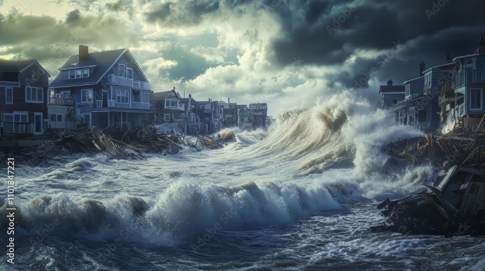
Rising sea levels raise the baseline water height, so when a storm surge arrives the combined water level can inundate coastal areas far beyond historic flood extents, amplifying risk for ecosystems and human communities.
Quick Answer
Sea‑level rise is the long‑term increase in average ocean height caused mainly by melting ice sheets and thermal expansion of warming water. A storm surge is a rapid, wind‑driven rise in water that occurs during hurricanes or other intense storms. Because a higher sea level sets a new baseline, any surge adds to an already elevated shoreline, producing deeper and more extensive flooding. The scientific consensus is that both processes are accelerating, and the combined effect threatens coastal infrastructure, habitats, and public health. Uncertainty remains in regional projections and in how quickly communities can adapt.
Key Takeaways
- Sea‑level rise results from ice‑sheet melt and thermal expansion, contributing roughly 3 mm per year globally (IPCC AR6, 2021).
- Storm surges are driven by strong winds and low atmospheric pressure, can raise water levels by several meters during major hurricanes.
- A higher baseline sea level amplifies surge height, leading to more frequent and severe coastal flooding.
- Impacts vary by region, with low‑lying deltas, small islands, and densely populated coasts most vulnerable.
- Adaptation options—such as wetlands restoration, seawalls, and managed retreat—have trade‑offs and must be tailored to local conditions.
What Is Rising Sea Levels and Storm Surge: Why Flooding Gets Worse?
Rising sea level refers to the gradual increase in the average height of the world’s oceans relative to land. The term encompasses two primary physical mechanisms: (1) the addition of water from melting glaciers and the Greenland and Antarctic ice sheets, and (2) the expansion of seawater as it warms—known as thermal expansion. Storm surge, by contrast, is a short‑term, wind‑generated rise in sea level that accompanies intense cyclonic systems. It is distinct from ordinary tides because it is linked to storm dynamics rather than lunar‑solar gravitational forces. Together, these processes determine the total water height that reaches a coastline during a storm event.
How Does It Work?
1. Ice‑Sheet Melt and Thermal Expansion
When global temperatures rise, the Greenland and Antarctic ice sheets lose mass through surface melting and iceberg calving. Satellite gravimetry (e.g., NASA’s GRACE mission) shows that ice loss contributed about 0.7 mm yr⁻¹ to global sea‑level rise between 2003 and 2019. Simultaneously, warmer ocean water occupies more volume; ocean heat content analyses indicate that thermal expansion added roughly 1.5 mm yr⁻¹ over the same period.
2. Storm‑Generated Wind and Pressure Effects
During a hurricane, strong on‑shore winds push surface water toward the shore, while the storm’s low pressure allows the sea surface to rise (the inverse barometer effect). The combined effect can lift water several meters above normal tide levels. The surge height depends on storm intensity, forward speed, angle of approach, and coastal bathymetry.
3. Interaction of Baseline and Surge
When the baseline sea level is higher, the same storm surge adds to a larger starting point. For example, a 0.3 m (1 ft) sea‑level rise can increase the inundation depth of a 3 m surge by 10 %–20 %, extending flood reach inland by hundreds of meters in flat coastal plains.
What Does the Evidence Show?
Long‑term tide‑gauge records, satellite altimetry, and climate‑model simulations consistently demonstrate a global mean sea‑level rise of about 20 cm since 1900, with an acceleration to roughly 3.4 mm yr⁻¹ in the last two decades (IPCC AR6, 2021). Observational studies of recent hurricanes—such as Hurricane Harvey (2017) in Texas and Hurricane Ida (2021) in Louisiana—show that flood extents were larger than historical analogues, consistent with the added water from sea‑level rise. Attribution analyses using ensembles of climate models indicate that the probability of extreme surge events has increased in proportion to the sea‑level trend.
Main Causes or Drivers
Direct Physical Drivers
- Glacial and ice‑sheet melt: Accelerated loss from Greenland and Antarctica.
- Thermal expansion: Warming of the upper 700 m of the ocean.
- Storm dynamics: Stronger wind fields and slower storm translation speeds observed in some recent cyclones.
Underlying Drivers
- Greenhouse‑gas emissions: The primary driver of global warming, documented by multiple assessment reports.
- Land‑use change: Urbanization of coastlines reduces natural drainage and can amplify surge impacts.
- Subsidence: Ground sinking from groundwater extraction or natural tectonics can locally increase relative sea level.
Environmental and Human Impacts
Environmental Impacts
- Coastal wetlands and mangroves experience increased saltwater intrusion, reducing habitat quality for fish and birds.
- Coral reef systems can be smothered by sediment deposited during repeated flooding.
- Low‑lying islands risk permanent loss, leading to biodiversity extinction hotspots.
Human Health and Social Impacts
- Flooding contaminates drinking water supplies, raising the risk of water‑borne diseases.
- Storm‑related displacement disproportionately affects low‑income households lacking resources for relocation.
- Psychological stress and loss of cultural sites intensify community vulnerability.
Economic and Infrastructure Impacts
- Property damage from surge‑related flooding in the United States averaged $20 billion per major event between 2000 and 2020 (NOAA, 2022).
- Critical infrastructure—roads, power grids, wastewater treatment—faces repeated interruption, increasing maintenance costs.
- Tourism economies on small islands can suffer prolonged revenue loss after a single severe surge.
Regional Differences
Impact intensity varies with geography. In the Gulf of Mexico, gentle slopes allow surge water to travel far inland, while steep Pacific coasts limit inland penetration but can experience higher wave run‑up. Tropical deltas such as the Mekong and the Nile are especially vulnerable because subsidence adds to sea‑level rise, creating compound flooding. Conversely, high‑latitude coasts like Norway benefit from colder water that expands less, though they still face surge risk from intense extratropical cyclones.
What Scientists Know With High Confidence
What Scientists Know With High Confidence
- Global mean sea level is rising, driven primarily by thermal expansion and ice‑sheet melt.
- Storm surge height is strongly correlated with storm intensity, wind speed, and coastal bathymetry.
- A higher baseline sea level increases the depth and inland reach of any given surge.
- Low‑lying coastal regions experience the greatest relative flood risk.
What Remains Uncertain
What Remains Uncertain
Key uncertainties include the rate of future Antarctic ice‑sheet loss, which depends on poorly understood ice‑ocean interactions, and the extent to which climate change will alter tropical cyclone frequency versus intensity. Regional projections are also limited by gaps in high‑resolution topographic data and by socioeconomic factors that influence vulnerability. Improving satellite gravimetry, deploying more tide‑gauges, and refining climate‑impact models will reduce these uncertainties.
Common Misconceptions
Common Misconceptions
Misconception: Storm surge is the same as a tsunami.
Reality: A surge is wind‑driven and tied to atmospheric pressure, lasting hours to days; a tsunami is generated by seismic activity and arrives within minutes, with different wave characteristics.
Misconception: Sea‑level rise is only a future problem.
Reality: Sea level has already risen about 20 cm since the early 20th century, and many coastal cities are experiencing measurable increases in flood frequency.
Misconception: Building higher seawalls eliminates flood risk.
Reality: While seawalls can reduce overtopping, they may transfer risk to adjacent areas, cause erosion, and become overtopped if sea level continues to rise faster than the structure is upgraded.
Solutions and Limitations
Adaptation strategies fall into three broad categories:
- Hard engineering: Seawalls, surge barriers, and pumped drainage systems provide immediate protection but are costly, can have ecological side‑effects, and may require frequent upgrades.
- Nature‑based solutions: Restoring mangroves, salt‑marshes, and oyster reefs absorbs wave energy and offers habitat benefits. Their effectiveness depends on space availability and long‑term maintenance.
- Managed retreat: Relocating infrastructure out of high‑risk zones reduces future losses but involves complex social, economic, and political considerations.
Each approach has trade‑offs. Hard defenses may lock communities into a “defense‑only” mindset, while nature‑based measures may not suffice for extreme events without supplemental engineering. Managed retreat is often the most sustainable long‑term option but requires clear policy frameworks and community engagement.
What Individuals, Communities, and Governments Can Do
What Individuals Can Do
- Support local zoning reforms that limit new development in flood‑prone zones.
- Participate in community‑based wetland restoration projects.
- Advocate for stronger greenhouse‑gas reduction policies that address the root cause of sea‑level rise.
What Communities and Organizations Can Do
- Conduct vulnerability assessments that incorporate both sea‑level projections and surge scenarios.
- Invest in green infrastructure—e.g., living shorelines—to complement hard defenses.
- Develop emergency‑response plans that consider compound flooding (storm surge plus heavy rain).
What Governments Can Do
- Implement and enforce building codes that require elevated structures in at‑risk areas.
- Allocate funding for large‑scale ecosystem restoration that provides natural flood buffers.
- Integrate sea‑level rise projections into long‑term coastal planning and infrastructure budgeting.
Synthesis
Rising sea levels and storm surges interact to produce flooding that is deeper, farther inland, and more frequent than in the past. The mechanisms—ice‑sheet melt, thermal expansion, and storm dynamics—are well documented, and high‑confidence science confirms that a higher baseline amplifies surge impacts. Regional differences arise from local topography, subsidence, and socioeconomic factors. While uncertainties remain about the speed of ice loss and future storm patterns, the evidence already supports a suite of adaptation measures that blend engineering, ecosystem restoration, and strategic retreat. Coordinated action across individuals, communities, and governments offers the most robust path to protect lives, economies, and coastal ecosystems from worsening floods.
Frequently Asked Questions
What is the difference between sea‑level rise and storm surge?
Sea‑level rise is the long‑term increase in average ocean height caused by melting ice and thermal expansion, while storm surge is a short‑term, wind‑driven rise in water level that occurs during a storm.
How does a higher sea level make storm surges more dangerous?
A higher baseline sea level means that any surge adds to an already elevated water height, resulting in deeper inundation and allowing floodwaters to travel farther inland than they would under lower sea‑level conditions.
Which regions are most vulnerable to combined sea‑level rise and storm surge?
Low‑lying deltas, small island nations, and densely populated coastal plains—such as the Gulf of Mexico, the Mekong Delta, and the Caribbean—face the greatest relative flood risk because of gentle slopes and often additional subsidence.
What are nature‑based solutions for reducing surge impacts?
Restoring mangroves, salt‑marshes, and oyster reefs can absorb wave energy and reduce surge height, while also providing habitat, carbon storage, and water‑quality benefits.
Why is managed retreat considered a viable adaptation strategy?
Managed retreat involves relocating structures out of high‑risk zones, which eliminates future flood damage and avoids the escalating costs of maintaining and upgrading hard defenses as sea level continues to rise.






Leave a Comment