
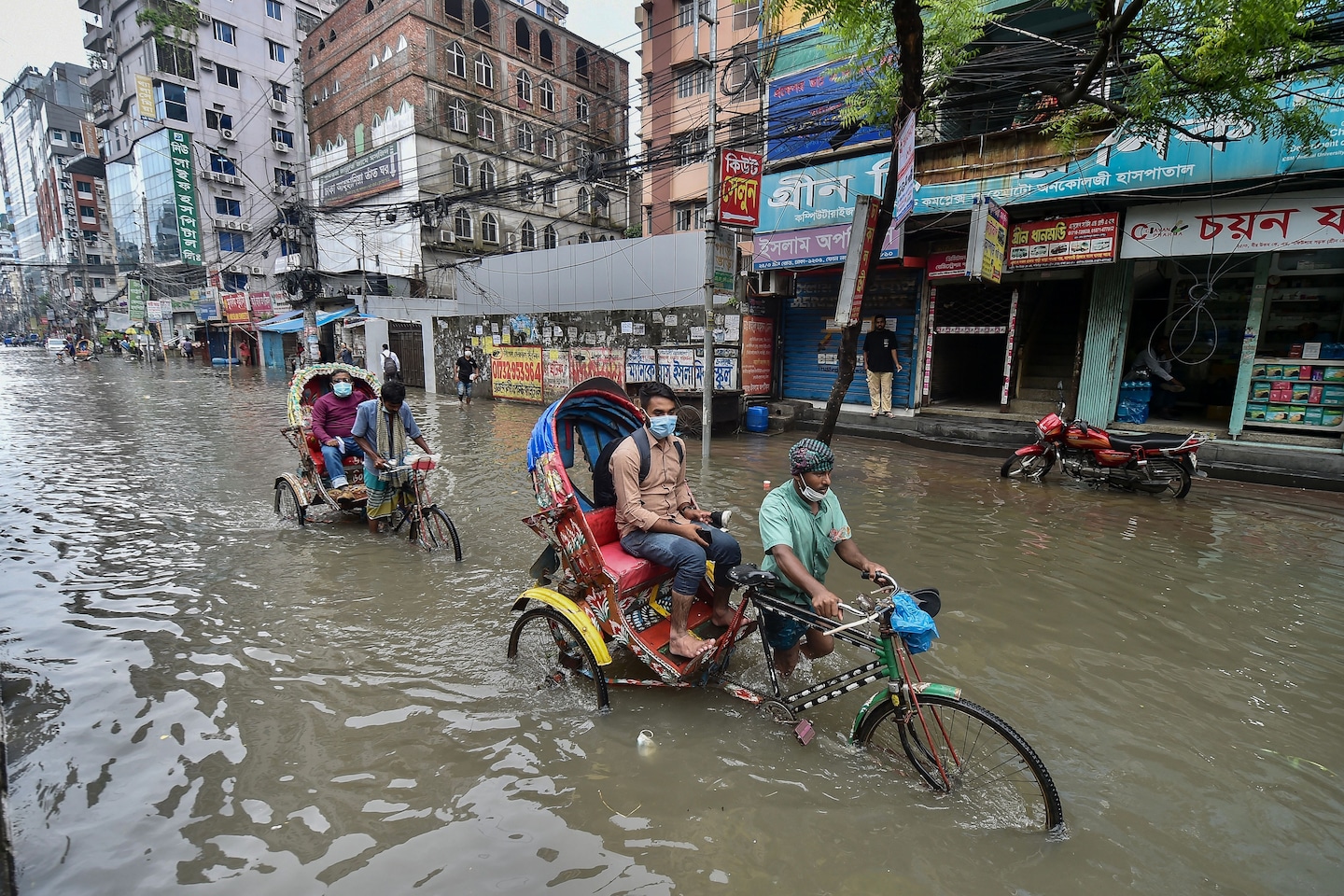
An estimated 86 million people now reside in flood‑prone areas worldwide, a figure driven by rising sea levels and intensified rainfall linked to climate change, with profound environmental and social consequences.
Quick Answer
Climate change is expanding the geographic reach of flooding through two main mechanisms: sea‑level rise, which pushes coastal water onto low‑lying land, and a warmer atmosphere that holds more moisture, leading to heavier precipitation events inland. The Intergovernmental Panel on Climate Change (IPCC) reports that these processes have already increased the number of people exposed to flood risk to roughly 86 million globally. While the exact future exposure depends on emission pathways and adaptation actions, the consensus is that without rapid mitigation, exposure will continue to grow.
Key Takeaways
- Sea‑level rise and intensified rainfall have pushed 86 million people into flood zones.
- Low‑income and coastal communities face the highest vulnerability.
- Evidence from satellite altimetry, river‑gauge networks, and climate models underpins the exposure estimates.
- Adaptation measures such as managed retreat, green infrastructure, and early‑warning systems can reduce risk but require substantial investment.
- Uncertainties remain around regional population growth and the exact magnitude of future climate extremes.
What Is 86 Million People Now Living in Global Flood Zones Due to Climate Change?
The phrase refers to the total number of individuals whose primary residence falls within areas identified as having a heightened probability of flooding because of climate‑driven changes. These zones are defined using flood‑hazard maps that incorporate sea‑level projections and precipitation trends. The estimate does not include transient populations or tourists, focusing instead on long‑term dwellers whose homes, livelihoods, and community services are situated in the at‑risk area.
How Does It Work?
1. Sea‑Level Rise
Thermal expansion of seawater and the melting of glaciers add water to the oceans. Satellite observations from NASA’s TOPEX/Poseidon mission show an average global rise of about 3.3 mm per year between 1993 and 2020. As sea level climbs, coastal plains that were previously dry become inundated during high tides and storm surges.
2. Intensified Precipitation
A warmer atmosphere can hold roughly 7 % more water per degree Celsius (Clausius‑Clapeyron relation). This leads to more frequent and severe rainstorms, especially in tropical and mid‑latitude regions. River‑basin monitoring by the World Meteorological Organization records increased peak discharge in many major watersheds.
3. Human Exposure Pathways
Population growth, urban expansion, and the conversion of wetlands to housing increase the number of people living where flood water can reach. Development often proceeds faster than flood‑risk assessments can be updated, creating a mismatch between land use and hazard reality.
What Does the Evidence Show?
Multiple lines of evidence converge on the 86 million figure. The IPCC Sixth Assessment Report (2021) synthesised satellite altimetry, tide‑gauge records, and climate‑model ensembles to estimate that global flood exposure rose by about 20 % between 1990 and 2015. A peer‑reviewed systematic review in Nature Climate Change (2022) corroborated these findings, noting that low‑lying coastal megacities such as Dhaka, Lagos, and New Orleans account for a disproportionate share of the exposed population. Regional case studies—from the Mekong Delta (NOAA, 2020) to the Nile Delta (World Bank, 2021)—show consistent trends of expanding flood plains and increasing damage costs.
Main Causes or Drivers
Direct Climate Drivers
- Global mean surface temperature increase of ~1.1 °C above pre‑industrial levels (IPCC, 2021).
- Sea‑level rise of 0.20 m since 1900, accelerating in recent decades.
- Increase in extreme precipitation events, with the frequency of >20 mm h⁻¹ storms rising by 15 % in many subtropical regions.
Underlying Human Drivers
- Rapid coastal urbanisation—more than 55 % of the world’s population now lives within 100 km of a coast.
- Land‑use change that reduces natural flood buffers such as mangroves and wetlands.
- Greenhouse‑gas emissions that sustain warming trends.
Environmental and Human Impacts
Environmental Impacts
Inundation alters soil chemistry, leading to salinization of agricultural lands and loss of freshwater habitats. Coastal ecosystems like mangroves and coral reefs suffer from both physical damage and increased sedimentation, reducing biodiversity and the services these systems provide.
Human Health and Social Impacts
Floodwaters can spread water‑borne pathogens, increasing diarrheal disease risk, especially among children under five. Displacement creates temporary or permanent migration, straining urban infrastructure and social services in receiving areas.
Economic and Infrastructure Impacts
World Bank estimates that flood‑related damages cost low‑income economies an average of 0.5 % of GDP annually. Critical infrastructure—roads, power lines, and water treatment plants—faces repeated repair cycles, undermining long‑term development.
Regional Differences
Exposure is not uniform. In South‑East Asia, dense river deltas amplify river‑flood risk, while in West Africa, rising sea levels threaten low‑lying coastal settlements. In contrast, high‑latitude regions such as Scandinavia experience slower sea‑level rise but may see increased river flooding from meltwater. Governance capacity also varies: some nations have robust early‑warning systems (e.g., Japan), whereas others lack basic flood mapping.
What Scientists Know With High Confidence
- Global average sea level has risen steadily since the late 19th century, driven primarily by thermal expansion and ice melt.
- A warmer atmosphere holds more moisture, leading to statistically significant increases in extreme precipitation frequency.
- Population growth in coastal zones outpaces the rate at which many countries update flood‑risk maps.
- Without mitigation, the number of people living in flood zones will continue to rise.
What Remains Uncertain
Key uncertainties include the exact rate of future ice‑sheet contribution to sea‑level rise, regional variations in precipitation response to warming, and how socioeconomic development will alter exposure patterns. Improved high‑resolution climate modeling and expanded ground‑based monitoring are needed to narrow these knowledge gaps.
Common Misconceptions
Misconception: Flooding is only a local weather problem.
Reality: While any single flood event is weather‑driven, the increasing frequency and geographic spread of floods are linked to long‑term climate trends that alter baseline conditions.
Misconception: Only poor countries are affected.
Reality: High‑income nations also host large coastal populations; however, vulnerability is amplified where adaptive capacity is limited, which often aligns with lower‑income contexts.
Misconception: Building higher levees solves the problem.
Reality: Hard engineering can provide temporary protection but may worsen downstream risk and does not address the root cause of rising water levels.
Solutions and Limitations
Effective responses combine mitigation (reducing greenhouse‑gas emissions) with adaptation (protecting people already at risk). Nature‑based solutions—restoring wetlands, mangroves, and floodplains—absorb water and provide co‑benefits for biodiversity, yet they require land‑use trade‑offs and long‑term maintenance. Managed retreat, the planned relocation of communities from high‑risk zones, offers a durable safety net but involves complex social, economic, and cultural considerations. Urban planning that integrates green roofs, permeable pavements, and zoning restrictions can reduce runoff, though implementation costs can be high for dense cities.
What Individuals, Communities, and Governments Can Do
What Individuals Can Do
- Support policies that aim for net‑zero emissions to limit future sea‑level rise.
- Participate in local flood‑risk mapping initiatives and advocate for transparent zoning.
- Adopt household measures such as rain‑water harvesting and flood‑resilient landscaping.
What Communities and Organizations Can Do
- Develop and regularly update community‑based early‑warning systems.
- Invest in green infrastructure projects that increase infiltration and storage capacity.
- Create relocation assistance plans for neighborhoods projected to become untenable.
What Governments Can Do
- Integrate climate‑adjusted flood maps into all new development permits.
- Allocate funding for retrofitting critical infrastructure to withstand higher water levels.
- Enact and enforce emissions reduction targets in line with the Paris Agreement to curb long‑term sea‑level rise.
Synthesis
The presence of 86 million people in climate‑induced flood zones reflects a clear link between global warming, sea‑level rise, and intensified precipitation. High‑confidence science confirms that these processes are underway, while uncertainties centre on the precise magnitude of future changes and socioeconomic pathways. Reducing emissions, protecting natural flood buffers, and planning for managed retreat together form a pragmatic portfolio of actions. By aligning individual choices, community initiatives, and strong governmental policies, societies can lower exposure, safeguard livelihoods, and preserve ecosystems for generations to come.
Frequently Asked Questions
How is the number of people living in flood zones calculated?
Researchers overlay global population grids with flood‑hazard maps that incorporate sea‑level rise and extreme‑rainfall projections. The intersecting areas give an estimate of how many residents reside in zones where flooding is likely under current climate conditions.
Why are low‑income communities more vulnerable to flooding?
Low‑income households often settle in affordable, low‑lying areas with limited infrastructure and fewer resources for flood defenses. These communities also have less capacity to recover after a flood, making them disproportionately affected.
What role does sea‑level rise play compared to heavier rainfall?
Sea‑level rise primarily expands coastal flood zones, pushing water onto land that was previously dry. Heavier rainfall increases inland river flooding and flash floods. Both mechanisms act together, widening the overall area exposed to flood risk.
Can nature‑based solutions fully protect people from floods?
Nature‑based approaches like restoring wetlands and mangroves can absorb water and reduce flood peaks, offering valuable protection. However, they work best alongside engineered measures and cannot alone guarantee safety for all at‑risk populations.
What is managed retreat and when is it considered?
Managed retreat involves the planned relocation of communities from high‑risk flood zones to safer areas. It is considered when protection measures become economically or technically unfeasible, or when long‑term risk remains unacceptably high.




Leave a Comment