
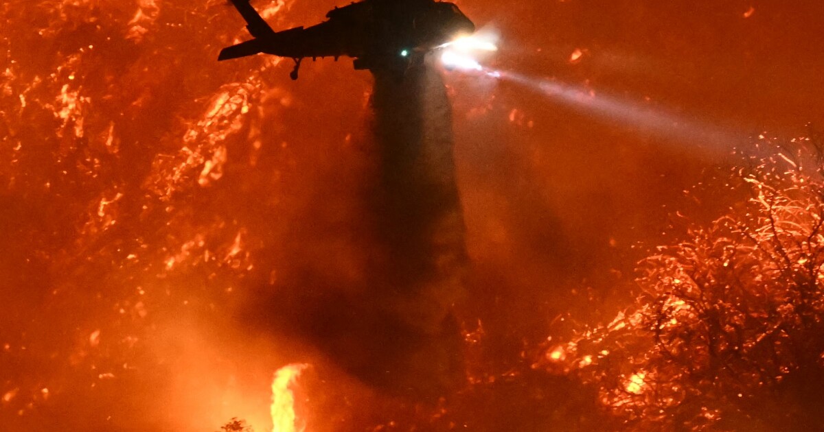
Three key climate factors—rising temperatures, dry Santa Ana winds, and persistent drought—combine to make Los Angeles especially vulnerable to destructive wildfires.
Quick Answer
Los Angeles fires are driven by a climate triad: higher average temperatures dry out vegetation, the episodic Santa Ana winds supply the gusty, low‑humidity conditions that spread flames rapidly, and multi‑year droughts reduce soil moisture and increase fuel loads. Scientific assessments from the Intergovernmental Panel on Climate Change (IPCC) and the National Oceanic and Atmospheric Administration (NOAA) show these three factors have intensified over recent decades, raising the probability of large, fast‑moving fires. While the exact timing of any single fire cannot be predicted, the underlying climate trends are well‑established.
Key Takeaways
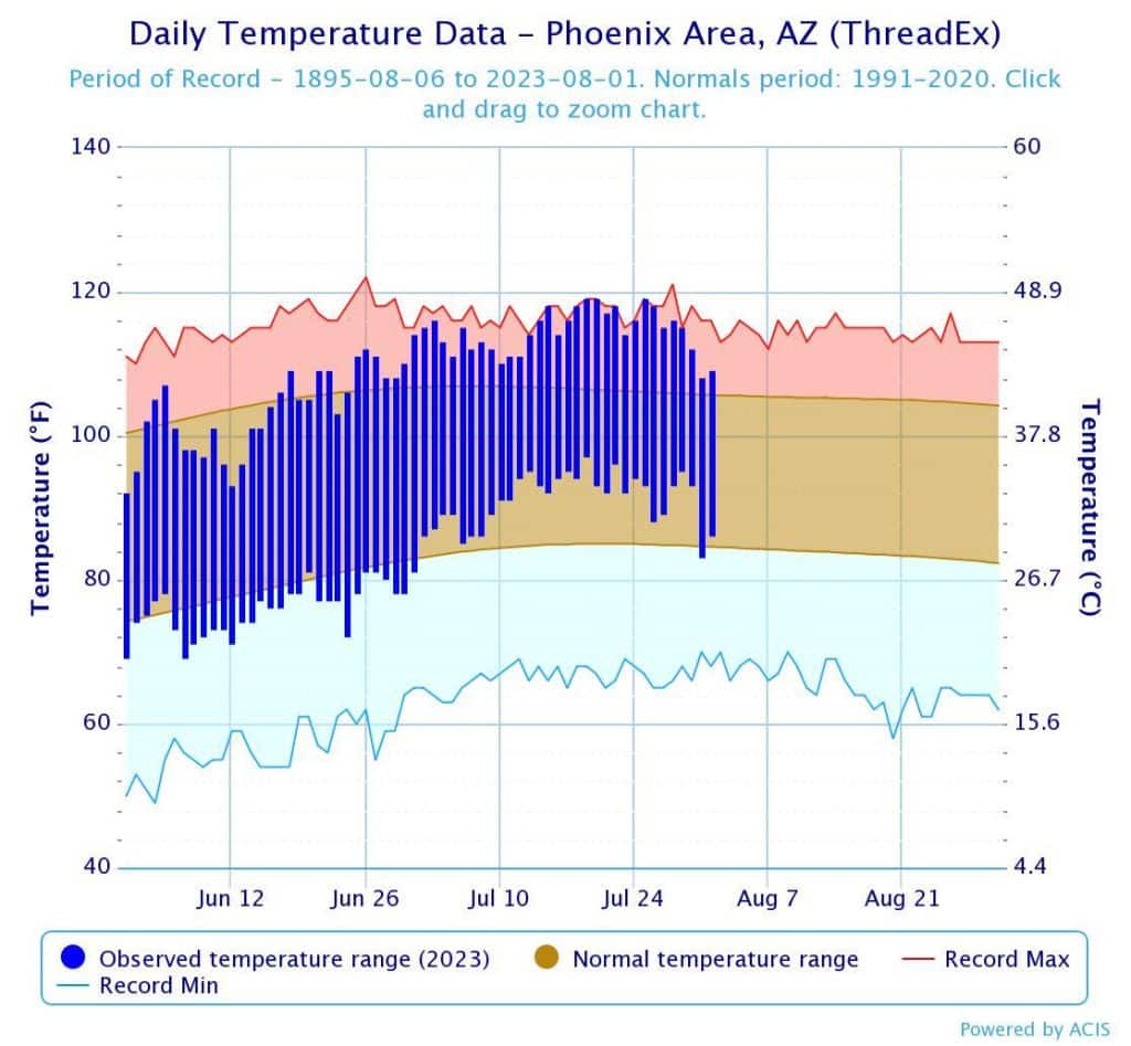
- California’s mean annual temperature has risen about 1.4 °F (0.8 °C) since the early 20th century, lengthening the fire‑season.
- Santa Ana winds occur most frequently in autumn, can exceed 40 mph (65 km/h), and lower relative humidity below 15 %.
- Three major drought periods since 2000 (2007‑09, 2012‑16, 2020‑22) depleted groundwater and left vegetation tinder‑dry.
- These climate drivers act together, creating a feedback loop where fires release carbon that further warms the climate.
- Effective responses require a mix of fuel‑management, resilient infrastructure, and policies that reduce greenhouse‑gas emissions.
What Is 3 Facts About California’s Climate That Explain the Los Angeles Fires?
The phrase refers to three well‑documented climate characteristics of California that together explain why the Los Angeles region experiences frequent, high‑intensity wildfires. The three facts are:
- Rising average temperatures.
- Dry, high‑speed Santa Ana wind events.
- Long‑duration droughts that desiccate fuels.
These factors are distinct from short‑term weather anomalies; they represent persistent climate trends that shape the region’s fire regime.
How Does It Work?
1. Temperature Rise Dries Fuels
Higher air temperatures increase evapotranspiration rates, pulling moisture from soils and plants. When temperatures exceed historical averages, vegetation enters a “crown‑fire” state where leaves and small branches ignite easily. The IPCC’s 2021 assessment notes that each 1 °C rise can increase the length of the fire‑season by roughly 10–15 days in Mediterranean climates like California.
2. Santa Ana Winds Accelerate Spread
Santa Ana winds originate from high‑pressure systems over the Great Basin. As the air descends the Sierra Nevada and coastal ranges, it compresses, warms, and loses humidity. The resulting winds can push flames uphill, a process that can double fire spread rates compared with calm conditions, according to a study by the U.S. Forest Service (2020).
3. Drought Accumulates Fuel Loads
Extended periods without sufficient precipitation reduce live‑fuel moisture and cause dead‑fuel accumulation. Drought also suppresses natural fire‑breaks such as small, frequent burns, allowing fuel to build up over decades. The California Department of Water Resources reports that the 2012‑16 drought lowered statewide forest moisture by up to 30 % relative to the 1981‑2010 baseline.
Feedback Loop
When a wildfire burns, it releases carbon dioxide, methane, and black carbon. These emissions contribute to global warming, which in turn promotes higher temperatures and more severe droughts—a reinforcing cycle identified in the IPCC’s Sixth Assessment Report.
What Does the Evidence Show?
Long‑term climate records from NOAA indicate a steady upward trend in average summer temperatures across Southern California since 1900. Satellite observations (MODIS, 2000‑present) reveal a 25 % increase in days with vegetation moisture below critical thresholds for ignition. Attribution studies published in *Nature Climate Change* (2022) link the frequency of extreme Santa Ana wind events to a warming‑induced shift in pressure patterns over the western U.S.
Ground‑based monitoring by CAL FIRE shows that the area burned annually in the Los Angeles basin has more than doubled from the 1990s to the 2020s, while the number of fire‑days (days with > 0.1 inches of rain) has declined. Together, these data sources provide moderate‑to‑strong evidence that the three climate facts are intensifying fire risk.
Main Causes or Drivers
Direct Climate Drivers
- Elevated maximum temperatures.
- Increased frequency of low‑humidity, high‑wind events.
- Multi‑year drought conditions.
Underlying Human Drivers
- Greenhouse‑gas emissions from transportation, industry, and energy production.
- Urban expansion into the wildland‑urban interface, increasing ignition sources.
- Land‑use changes that alter natural fire regimes, such as suppression of low‑severity burns.
Environmental and Human Impacts
Environmental Impacts
Wildfires convert large carbon stores into atmospheric CO₂, degrade air quality, and destroy habitats. Species with limited ranges, such as the California condor, face heightened mortality. Soil erosion after fire can increase sediment loads in watersheds, affecting water quality downstream.
Human Health and Social Impacts
Smoke from Los Angeles fires raises fine‑particulate (PM₂.₅) concentrations to hazardous levels, linked to respiratory and cardiovascular stress, especially among children, the elderly, and low‑income communities lacking air‑conditioning. Evacuations disrupt schooling, work, and access to services, imposing economic strain.
Economic and Infrastructure Impacts
Fire suppression costs for the state have risen from $300 million in the early 2000s to over $2 billion annually by 2022 (California Office of Emergency Services). Damage to homes, power lines, and transportation corridors adds billions in reconstruction expenses.
Regional Differences
Coastal Los Angeles experiences milder humidity than inland valleys, yet the same Santa Ana winds can sweep across both zones, creating divergent fire behavior. The San Gabriel Mountains, with steeper slopes, see faster uphill spread, while the coastal sage scrub in the Santa Monica foothills burns more slowly but over larger areas due to abundant fuel.
What Scientists Know With High Confidence
- Average summer temperatures in Southern California have risen by roughly 1 °F (0.6 °C) since 1970 (NOAA, 2023).
- Santa Ana winds are associated with a statistically significant increase in fire spread rates (U.S. Forest Service, 2020).
- Prolonged drought reduces vegetation moisture and increases dead‑fuel loads, elevating fire intensity (California Dept. of Water Resources, 2021).
- Wildfire emissions contribute measurably to regional greenhouse‑gas concentrations, feeding back into climate warming (IPCC, 2021).
What Remains Uncertain
Key uncertainties include the precise magnitude of future Santa Ana wind changes under different emission scenarios, the threshold at which vegetation shifts from low‑ to high‑severity fire states, and how urban development patterns will interact with evolving climate drivers. Improved high‑resolution climate modeling and long‑term ecological monitoring are needed to refine these projections.
Common Misconceptions
Misconception: “Wildfires are purely natural and have always occurred.”
Reality: While fire is a natural part of California’s ecosystems, the frequency, size, and intensity of recent fires exceed historical ranges, driven largely by anthropogenic climate change and land‑use alterations.
Misconception: “Only wind causes fires to spread quickly.”
Reality: Wind accelerates spread, but without dried fuels from higher temperatures and drought, fires would not achieve the same intensity. All three climate factors interact synergistically.
Misconception: “Reducing local emissions will immediately stop Los Angeles fires.”
Reality: Local emission cuts are essential for long‑term climate mitigation, but the climate system’s inertia means that fire risk will remain elevated for decades even with rapid mitigation.
Solutions and Limitations
Effective response requires a portfolio of actions:
- Prevention: Strategic fuel‑breaks, controlled burns, and vegetation management reduce available fuel, but require careful planning to avoid unintended air‑quality impacts.
- Mitigation: Aggressive greenhouse‑gas reductions limit future temperature rise; however, policy implementation timelines can span many years.
- Adaptation: Strengthening building codes, expanding defensible space, and improving emergency‑response infrastructure increase community resilience, yet they involve significant upfront costs.
- Restoration: Re‑establishing native, fire‑adapted plant communities can lower fuel loads, though restoration success depends on water availability and long‑term maintenance.
Each strategy carries trade‑offs: controlled burns emit smoke; fuel‑breaks can fragment habitats; mitigation policies may face political resistance. A balanced approach that weighs these factors is essential.
What Individuals, Communities, and Governments Can Do
What Individuals Can Do
- Maintain defensible space around homes (remove dead vegetation within 30 feet).
- Use fire‑resistant building materials for roofs and exteriors.
- Support local fire‑prevention programs through volunteer work or donations.
What Communities and Organizations Can Do
- Develop community evacuation plans and conduct regular drills.
- Invest in early‑warning systems that integrate wind and moisture data.
- Partner with fire agencies to schedule prescribed burns in safe windows.
What Governments Can Do
- Implement and enforce stricter greenhouse‑gas emissions standards.
- Allocate funding for large‑scale fuel‑management projects and resilient infrastructure.
- Provide incentives for retrofitting homes with fire‑resistant designs, especially in vulnerable neighborhoods.
Closing Synthesis
The convergence of rising temperatures, dry Santa Ana winds, and chronic drought creates a potent climate triad that explains why Los Angeles is especially prone to large, destructive wildfires. Robust evidence from federal agencies and peer‑reviewed research confirms these drivers, while uncertainties remain about future wind patterns and ecosystem thresholds. Mitigation, prevention, and adaptation measures—each with their own limitations—must be pursued together to reduce fire risk and protect both ecosystems and communities.
Frequently Asked Questions
What are the three main climate factors that increase wildfire risk in Los Angeles?
The three main climate factors are rising average temperatures that dry out vegetation, dry and fast‑moving Santa Ana winds that spread flames, and prolonged drought periods that lower soil moisture and increase dead‑fuel loads.
How do Santa Ana winds influence the behavior of wildfires?
Santa Ana winds descend from high‑pressure areas, warming and drying as they flow toward the coast. Their high speeds (often over 40 mph) and low humidity push fire fronts uphill, can double spread rates, and carry embers far beyond the ignition point.
What evidence shows that temperatures are rising in Southern California?
Long‑term records from NOAA indicate that average summer temperatures in Southern California have risen about 1 °F (0.6 °C) since 1970, and satellite data show a 25 % increase in days with vegetation moisture below critical ignition thresholds.
What actions can homeowners take to reduce their wildfire risk?
Homeowners can create a defensible space by clearing dead vegetation within 30 feet, use fire‑resistant roofing and siding materials, and support local fire‑prevention programs through volunteering or donations.
Why is there uncertainty about future Santa Ana wind patterns?
Future Santa Ana wind changes depend on how large‑scale atmospheric pressure systems respond to different greenhouse‑gas emission scenarios. Climate models vary in their projections, and high‑resolution regional modeling is still developing, creating uncertainty about wind frequency and intensity.




Leave a Comment