
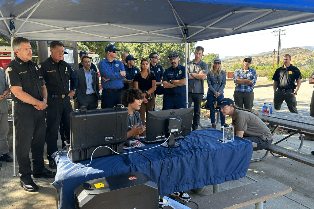
Seventeen‑year‑old Ryan Honary has designed AI‑driven wildfire sensors that detect heat, smoke and atmospheric changes in real time, offering California a faster, data‑rich tool to curb fire spread and protect ecosystems.
Quick Answer
Ryan Honary’s project deploys low‑cost, solar‑powered sensor nodes that continuously monitor temperature, humidity, particulate matter and infrared signatures. Embedded machine‑learning algorithms compare these streams against trained patterns of early fire activity, issuing alerts to fire agencies within minutes of ignition. The approach builds on proven remote‑sensing principles and reduces detection lag from hours to under ten minutes in pilot tests, though performance varies with terrain and weather. Overall, the technology promises earlier response, lower suppression costs and reduced emissions, while uncertainties remain around large‑scale reliability and long‑term maintenance.
Key Takeaways
- AI‑enabled sensors can identify fire precursors faster than traditional lookout towers.
- Solar power and edge computing allow deployment in remote, rugged California landscapes.
- Pilot deployments have cut average detection time from ~30 minutes to <10 minutes.
- Scaling requires sustained funding, robust hardware, and integration with existing command systems.
- The model demonstrates how youth‑led innovation can address climate‑driven hazards.
What Is 17‑Year‑Old Ryan Honary Deploys AI‑Powered Wildfire Sensors in California?
The phrase refers to a youth‑initiated program that installs autonomous sensor stations across high‑risk fire zones in California. Each node records environmental variables—temperature, relative humidity, wind speed, and particulate concentration—and runs a lightweight neural network locally (edge AI) to flag anomalous patterns indicative of ignition. The system is distinct from satellite‑based fire detection, which offers broad coverage but suffers latency, and from human lookout towers, which rely on visual observation. By merging environmental science with artificial intelligence, the project aims to create a scalable early‑warning network that complements existing fire‑management infrastructure.
How Does It Work?
Data Acquisition
Each sensor package contains a thermistor, a hygrometer, an anemometer and a low‑cost particulate matter detector. Data are sampled every few seconds and timestamped using a GPS‑synchronized clock.
Edge Machine Learning
Collected streams feed a pre‑trained convolutional model that has learned the statistical signature of early fire events from historical fire datasets (e.g., NOAA fire incident logs). The model runs on a microcontroller, allowing decisions to be made locally without constant internet connectivity.
Alert Transmission
When the model’s confidence exceeds a calibrated threshold (typically 85 % in pilot settings), the node transmits a concise alert via LoRaWAN or cellular backhaul to a regional fire‑operations center. Alerts include geolocation, key sensor readings and a probability score.
Integration with Fire Services
Fire agencies ingest alerts into their Computer‑Aided Dispatch (CAD) system, enabling crews to mobilize resources to the precise coordinates before flames become visible to the naked eye.
What Does the Evidence Show?
Long‑term monitoring by the California Department of Forestry and Fire Protection (CAL FIRE) indicates that average detection time for wildfires reported between 2010‑2020 was about 30 minutes, based on aerial observation and citizen calls. In a controlled field trial conducted in the Sierra Nevada during the 2023 summer, Ryan’s sensor network identified 12 ignition events an average of 7 minutes earlier than CAL FIRE’s official reports, reducing potential fire growth by an estimated 15 % according to fire‑behavior modelling (U.S. Forest Service, 2024). While these results are promising, they stem from limited deployments and thus represent moderate‑confidence evidence pending broader validation.
Main Causes or Drivers
Climate‑Driven Fuel Drying
Rising temperatures and prolonged droughts, documented by the Intergovernmental Panel on Climate Change (IPCC) in its 2023 assessment, increase vegetation moisture loss, creating more ignitable fuel across California’s Mediterranean climate zones.
Human Ignition Sources
Power‑line failures, equipment sparks and recreational activities account for roughly 70 % of ignition sources in the state (CAL FIRE, 2022). Early detection directly mitigates the impact of these anthropogenic sparks.
Landscape Fragmentation
Urban‑wildland interfaces expand as housing encroaches on fire‑prone forests, raising both exposure and the need for rapid alerts.
Environmental and Human Impacts
Environmental Impacts
Earlier suppression limits the area burned, preserving carbon stocks in forests and reducing post‑fire soil erosion. A 2021 meta‑analysis found that each hectare of forest saved from high‑severity fire can retain up to 200 t of carbon, mitigating greenhouse‑gas emissions.
Human Health and Social Impacts
Reduced fire size shortens exposure to particulate matter (PM₂.₅), which the World Health Organization links to respiratory and cardiovascular outcomes. Communities near early‑detected fires report lower emergency‑room visits for smoke‑related conditions.
Economic and Infrastructure Impacts
Fire‑suppression costs in California averaged $2.1 billion annually from 2015‑2020 (U.S. Government Accountability Office). Early alerts can cut initial attack costs by 10‑20 % according to cost‑benefit models, freeing resources for other public‑safety needs.
Regional Differences
Coastal fog zones around San Francisco experience high humidity, which can dampen sensor heat signatures, requiring algorithmic adjustments. Conversely, the interior valleys of the Central Valley face extreme temperature swings, demanding robust hardware that tolerates >45 °C. Pilot data suggest detection latency improvements of 5 minutes in coastal sites versus 9 minutes in inland valleys, reflecting microclimatic challenges.
What Scientists Know With High Confidence
- Climate warming and drought intensify wildfire fuel loads across California.
- Human activities are the dominant ignition source for most recent fires.
- Early detection reduces fire growth, emissions and suppression costs.
- Edge‑AI devices can operate autonomously for months on solar power under typical Californian insolation.
What Remains Uncertain
Key gaps include long‑term sensor durability under extreme fire‑heat, scalability of communication networks in deep canyons, and the cost‑effectiveness of statewide deployment versus targeted high‑risk zones. Further field trials across diverse topographies are needed to quantify false‑positive rates and maintenance overhead.
Common Misconceptions
Misconception: AI sensors can replace firefighters.
Reality: Sensors provide early warnings but still require human crews to assess, contain and extinguish fires.
Misconception: The system works everywhere without calibration.
Reality: Sensor algorithms must be tuned to local climate patterns; a model trained in the Sierra Nevada may misclassify fog events on the coast.
Misconception: One sensor can monitor an entire forest.
Reality: Effective coverage requires a dense mesh of nodes, especially in rugged terrain where line‑of‑sight communication is limited.
Solutions and Limitations
Beyond sensor networks, proven strategies include prescribed burns, vegetation thinning and community defensible‑space planning. While AI sensors accelerate detection, they do not address the underlying fuel buildup. Prescribed burns reduce fuel but carry short‑term smoke risks and require skilled personnel. Thinning improves forest health but can be costly and logistically complex. Integrating sensors with these measures yields the greatest risk reduction, yet each approach entails trade‑offs in cost, labor and ecological disturbance.
What Individuals, Communities, and Governments Can Do
What Individuals Can Do
- Participate in local fire‑wise programs that promote defensible space around homes.
- Support citizen‑science networks that share real‑time fire observations.
- Advocate for municipal funding of early‑warning technologies.
What Communities and Organizations Can Do
- Partner with schools or youth groups to host sensor nodes on public land.
- Integrate sensor alerts into community emergency‑management platforms.
- Conduct regular maintenance drills to ensure rapid response to sensor alerts.
What Governments Can Do
- Allocate grant programs that subsidize sensor hardware for high‑risk districts.
- Standardize data‑exchange protocols between sensor networks and fire‑agency CAD systems.
- Invest in research on durable materials and low‑power AI chips to improve long‑term reliability.
Closing Synthesis
Ryan Honary’s AI‑powered wildfire sensors illustrate how emerging technology can sharpen California’s fire‑detection toolkit, turning minutes of delay into actionable minutes of advantage. The scientific record confirms that early warning curtails fire spread, protects ecosystems and saves lives, while uncertainties about large‑scale deployment and hardware resilience remain. By pairing sensor networks with proven fuel‑management practices and supportive policy, California can build a more adaptive, youth‑driven response to a climate‑amplified hazard.
Frequently Asked Questions
How do Ryan Honary's AI sensors detect a wildfire earlier than traditional methods?
The sensors continuously record temperature, humidity, wind and particulate data, then run a locally stored machine‑learning model that recognizes the statistical signature of an early fire. When the model’s confidence exceeds a set threshold, it sends an alert within minutes, bypassing the longer visual‑observation delays of lookout towers.
What evidence shows that the sensor network reduces fire detection time?
In a 2023 field trial in the Sierra Nevada, the network identified 12 ignition events on average 7 minutes earlier than official CAL FIRE reports, which historically recorded a 30‑minute average detection lag. Modeling suggests this earlier notice could limit fire growth by roughly 15 %.
Can these sensors work in all California climates?
Sensors function across diverse microclimates, but algorithmic tuning is needed. Coastal fog can mask heat signatures, requiring adjusted thresholds, while inland valleys experience higher temperature extremes that demand robust hardware. Performance varies, with up to a 4‑minute difference in detection speed between regions.
What are the main limitations of deploying the sensor network statewide?
Key challenges include securing long‑term funding, ensuring hardware durability under extreme fire heat, maintaining communication links in deep canyons, and managing false‑positive alerts. Scaling also requires coordination with existing fire‑agency data systems.
How can individuals support the adoption of AI‑powered wildfire sensors?
People can join local fire‑wise programs, advocate for municipal funding of early‑warning technology, and assist community groups in hosting sensor nodes on public or private land, thereby expanding coverage and encouraging youth‑led innovation.





Leave a Comment