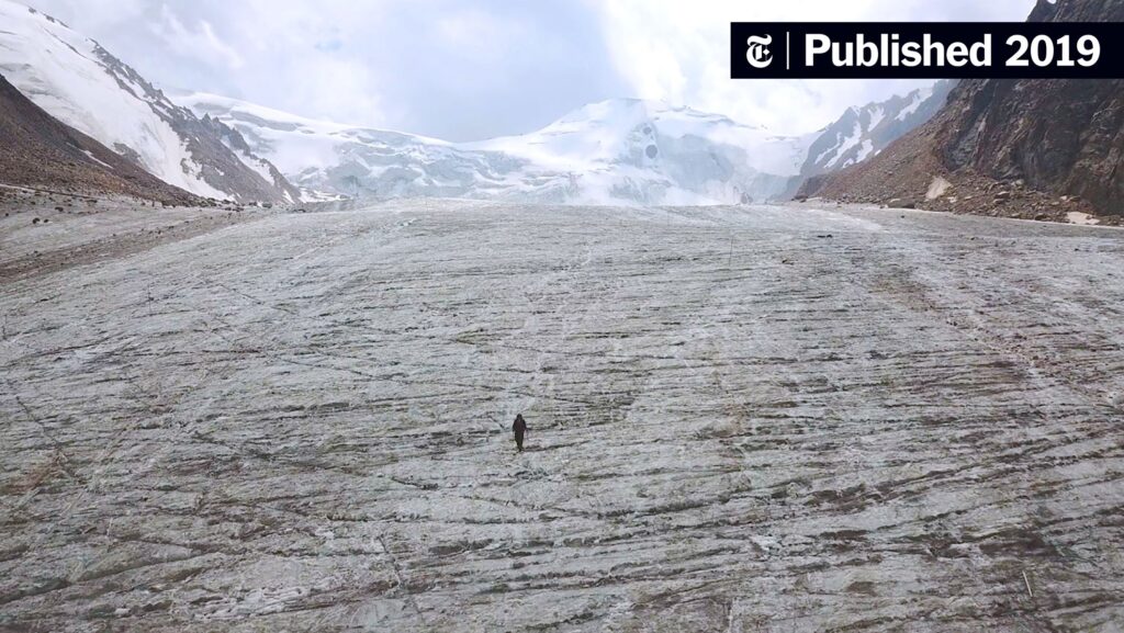
The vastness of our planet is often distilled into mere dots on a map or fleeting views from consistently shifting elevations. Yet, beyond the mundane interface of charts and graphs lies an intricate tapestry of ice, water, and time — one that is increasingly vulnerable to the caprices of climate change. Glaciers, those ancient rivers of ice, carve their stories over epochs, their grandeur juxtaposed with the relentless march of global warming. To comprehend their current narrative, scientists have turned their gaze skyward, employing avant-garde satellite technology to monitor and manage what once seemed impervious to change.
Central to this innovation is GLIMS, the Global Land Ice Measurements from Space initiative. Like a modern-day Prometheus, GLIMS has harnessed the power of satellite imagery to illuminate the hidden rhythms of glaciers from afar. In doing so, it transforms the icy masses, once merely subjects of geological observation, into dynamic characters in a narrative shaped by both human activity and natural cycles.
The satellites tasked with this monumental endeavor serve as vigilant sentinels, soaring above the terrestrial chaos. Equipped with sophisticated sensors capable of capturing minuscule variations in ice thickness, flow velocities, and terminus positions, they compile a comprehensive encyclopedia of glacial behavior. Imagine them as celestial scribes, documenting the evolution of ice as it reacts to shifting atmospheric and oceanic conditions, providing a panoramic perspective that terrestrial observers could never achieve.
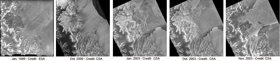
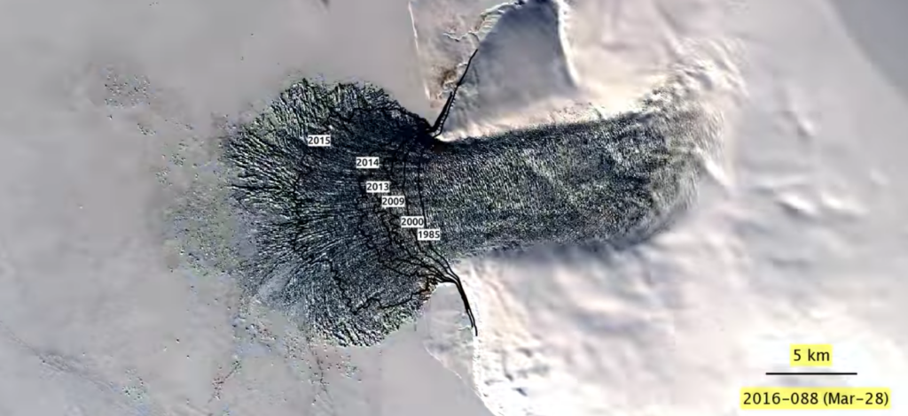
Each image captured serves as a crucial frame in a larger cinematic experience. For instance, the Sentinel-1 satellite utilizes synthetic aperture radar to unveil the hidden movements of glaciers, often invisible to the naked eye. Just like artists capturing the nuanced movements of their subjects, these satellites offer scientists vivid insights into glacial retreat or advance. Thus, the silent drama of ice unfolds across time, revealing not just the actions of the glaciers themselves, but also the precarious balance of ecosystems reliant on their frozen cauldrons.
Yet, the art of monitoring glacial activity transcends mere observation. The data amassed by GLIMS feeds into complex simulation models that predict future behaviors of these ice giants. These models act as crystal balls, offering glimpses into potential scenarios based on varying levels of greenhouse gas emissions. As scientists delve into these projections, they find themselves confronting the daunting reality that the glaciers are not merely passive entities in this narrative; they are active participants in the larger climate story — influencing sea levels, ocean currents, and even weather patterns.
This interplay between satellite data and climate modeling embodies a larger paradigm shift within environmental science. The synergy cultivates a deeper understanding of how local phenomena, such as the breakup of an ice dam, can create ripples of change that extend far beyond their origins. Indeed, these events remind us that neglecting the whispers of our glacial allies can lead to a cacophony of consequences, drowning coastal communities in inundations spawned by rapid sea-level rise.
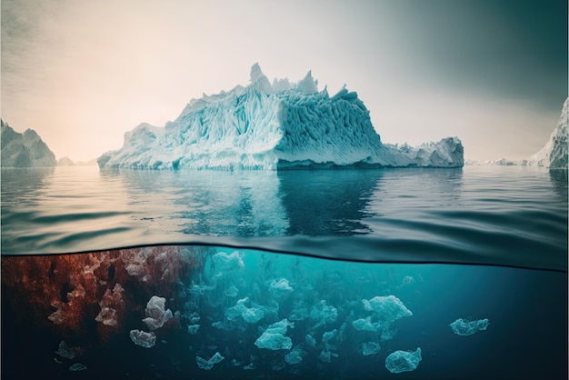
The aesthetic beauty of glaciers, often romanticized in literature and seen through the lens of adventure, belies their intrinsic fragility. GLIMS, through satellite imagery, juxtaposes this beauty against a stark reality, capturing the stark contrasts between the captivating panorama of glacial formations and the insidious encroachments of climate change. Each reduction in ice mass emerges not just as a statistic, but rather as a poignant reminder of the fragility of our environment—a testament to the stories lost when temperatures breach natural thresholds.
Furthermore, the satellites foster a sense of connection amongst those who observe these changes. As individuals tune into the data shared by GLIMS, a collective consciousness begins to form. Communities around the world engage in discussions that transcend geographical boundaries, making climate change not merely a matter of distant, abstract numbers, but rather a shared narrative that compels collective action. This conscience serves as a unifying force, invoking a narrative of resilience and tenacity — as humanity grapples with the daunting task of reclaiming its equilibrium.
The GLIMS initiative is a vivid tapestry weaving together the realms of science, technology, and activism. The marriage of satellite data and on-ground research represents a significant paradigm shift in how we approach environmental stewardship. Indeed, as our understanding deepens, so too does our responsibility to these frozen behemoths tirelessly sculpting our landscapes. In recognizing their fragility, we stand at a pivotal crossroads where the quest for knowledge converges with urgency, compelling us to act with intent, guided by the visions offered to us from above.
In conclusion, GLIMS epitomizes the convergence of technology and environmental awareness. Through the lens of satellites, we gain a holistic view of glaciers as both majestic formations and vital components of our global ecosystem. Their story is not simply one of ice, but of interconnectedness between our planet’s past, present, and future. As we continue to bear witness from our celestial vantage point, let us strive to write a new chapter — one characterized by reverence, informed action, and a renewed commitment to the guardianship of our planet’s icy giants.


Leave a Comment