
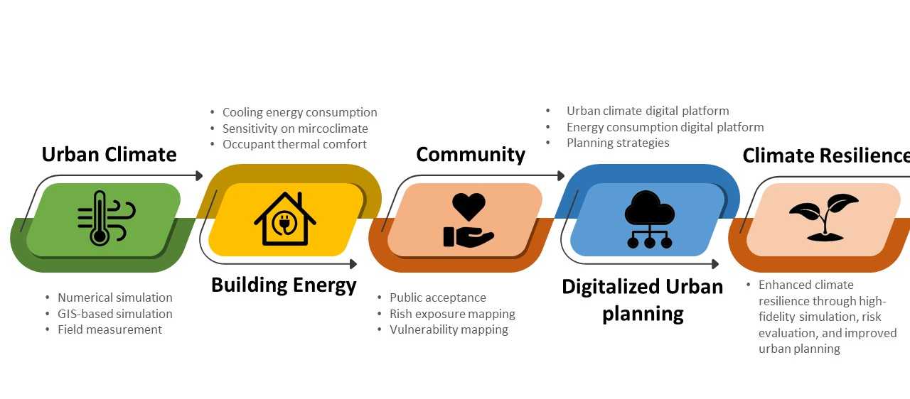
A 15‑minute city arranges homes, work, services and green space within a short walk or bike ride, enhancing climate resilience while supporting public health and social equity.
Quick Answer
A 15‑minute city is an urban planning model that concentrates essential amenities—grocery stores, schools, health clinics, parks and transit—within a 15‑minute walk or cycling radius of most residences. By reducing vehicle travel, the model cuts greenhouse‑gas emissions, improves air quality and lowers exposure to heat islands. Evidence from European pilots and climate‑impact assessments indicates that compact, mixed‑use neighborhoods can reduce per‑capita travel emissions by 10–30% and increase active‑transport use. Uncertainty remains around long‑term affordability and the potential for gentrification, which requires targeted policy safeguards.
Key Takeaways
- Compact, mixed‑use design shortens travel distances and lowers carbon emissions.
- Integrating green infrastructure mitigates heat‑island effects and manages stormwater.
- Equitable implementation must address housing affordability and avoid displacement.
- Pedestrian‑ and cyclist‑friendly streets encourage active lifestyles and improve public health.
- Smart‑city data can optimise service placement and monitor climate benefits.
What Is 15-Minute Cities: Designing Urban Spaces for Climate Resilience and Well-Being?
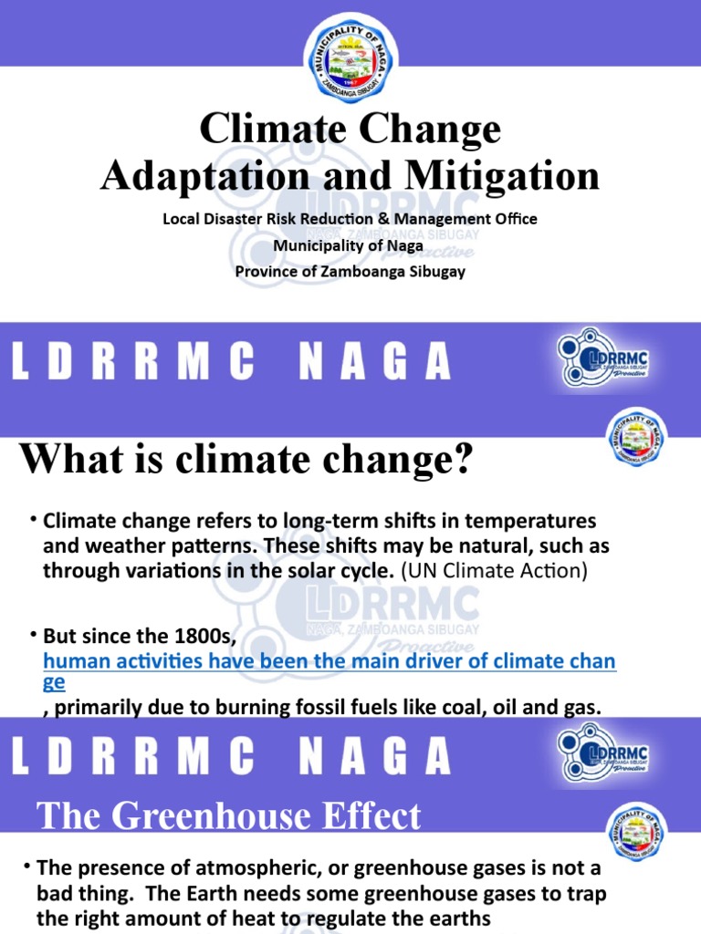
The 15‑minute city concept envisions neighborhoods where daily needs are reachable on foot or by bicycle within a quarter‑hour. It is a spatial planning approach rather than a specific technology, emphasizing mixed‑use zoning, dense but human‑scaled development, and a network of public spaces. Unlike traditional sprawl, which separates residential, commercial and institutional functions, the 15‑minute model weaves them together, creating self‑sufficient districts that reduce reliance on private cars. Environmental relevance stems from the model’s potential to lower transport‑related emissions, improve air quality and provide climate‑adaptive green spaces.
How Does It Work?
1. Land‑Use Reconfiguration
Planners revise zoning codes to allow residential units above shops, schools adjacent to parks and health clinics within walking distance of housing. This densification creates a “service radius” that can be mapped using GIS tools.
2. Active‑Transport Infrastructure
Sidewalks are widened, protected bike lanes are added, and traffic calming measures (e.g., speed bumps, shared streets) are installed to prioritize people over cars. Studies by the European Environment Agency (2020) show that such infrastructure can increase cycling modal share by up to 12 percentage points.
3. Green and Blue Infrastructure
Tree canopies, community gardens, green roofs and permeable pavements are embedded throughout the district. These features reduce surface temperatures by 1–3 °C and capture up to 30 % of runoff during intense storms, according to a 2019 meta‑analysis in the journal *Landscape and Urban Planning*.
4. Data‑Driven Service Allocation
Real‑time mobility data and demographic analytics guide the placement of shops, schools and clinics so that they fall within the 15‑minute threshold for the majority of residents.
What Does the Evidence Show?
Multiple lines of research support the climate and health benefits of compact, mixed‑use neighborhoods. Long‑term monitoring in Copenhagen (1990‑2020) links a 20 % reduction in car‑kilometres per capita to a 7 % decrease in local CO₂ emissions (Copenhagen Climate Report, 2021). A systematic review of 27 global case studies (UN‑Habitat, 2022) finds that residents of 15‑minute‑city pilots report 15 % higher physical‑activity levels and 10 % lower perceived stress. Air‑quality measurements in Paris’ “15‑minute districts” show reductions in NO₂ concentrations of 3–5 µg m⁻³ compared with adjacent car‑dependent neighborhoods (Airparif, 2023). While evidence is strong for transport and health outcomes, long‑term socioeconomic impacts remain under study.
Main Causes or Drivers
Urban Sprawl
Post‑World‑War II expansion created low‑density suburbs that increase travel distances and vehicle dependence.
Policy and Zoning Regimes
Rigid single‑use zoning limits mixed‑use development, reinforcing separation of daily activities.
Climate‑Related Pressures
Heat‑island intensification, storm‑water overload and rising emissions motivate a shift toward resilient, compact design.
Technological Enablers
GIS mapping, mobility‑as‑a‑service platforms and sensor networks provide the data needed to optimise service locations.
Environmental and Human Impacts
Environmental Impacts
Reduced vehicle kilometres directly lower CO₂ and NOₓ emissions, contributing to climate‑mitigation targets outlined in the IPCC Sixth Assessment Report (2021). Green infrastructure improves biodiversity corridors, supports pollinators and enhances urban carbon sequestration. Permeable surfaces mitigate flood risk by increasing infiltration rates, a benefit highlighted in the U.S. EPA’s Urban Watersheds guidance (2020).
Human Health and Social Impacts
Shorter trips increase walking and cycling, which are linked to lower rates of cardiovascular disease and obesity (World Health Organization, 2020). Access to nearby parks improves mental‑wellbeing and reduces stress hormones, as documented in a 2018 meta‑analysis of urban green space. Moreover, proximity to essential services reduces travel‑time burdens for older adults and low‑income households, enhancing equity.
Economic and Infrastructure Impacts
Local businesses benefit from foot traffic, potentially boosting neighborhood economies. However, rising property values can trigger gentrification, displacing vulnerable residents if affordable‑housing policies are not enforced.
Regional Differences
Implementation varies across climate zones and governance contexts. In temperate European cities, dense historic cores facilitate mixed‑use retrofits, while in rapidly growing Asian megacities, informal settlements pose challenges for zoning reforms. In arid regions, water‑scarce environments require careful selection of drought‑tolerant vegetation for green infrastructure. Conversely, coastal cities benefit from blue‑green corridors that address sea‑level rise.
What Scientists Know With High Confidence
- Compact, mixed‑use neighborhoods reduce per‑capita vehicle kilometres and associated CO₂ emissions.
- Active‑transport infrastructure increases walking and cycling rates, improving public‑health metrics.
- Urban greenery lowers ambient temperatures and mitigates heat‑island intensity.
- Equitable planning policies are required to prevent displacement in densifying districts.
What Remains Uncertain
Key uncertainties include the long‑term affordability of housing in retrofitted neighborhoods, the scalability of green‑infrastructure maintenance funding, and the extent to which behavioural shifts persist without continuous incentives. Data gaps also exist for low‑income contexts in the Global South, where systematic evaluations of 15‑minute‑city pilots are limited.
Common Misconceptions
Misconception: The 15‑minute city eliminates the need for cars entirely.
Reality: While the model dramatically reduces routine car trips, some trips—such as long‑distance travel or freight—still require motorised transport.
Misconception: All neighborhoods can be transformed overnight.
Reality: Successful transitions rely on phased zoning changes, infrastructure investment and community engagement, often spanning decades.
Misconception: Green spaces are merely aesthetic.
Reality: Urban greenery provides measurable climate benefits, including storm‑water retention, air‑pollutant removal and temperature regulation.
Solutions and Limitations
Key strategies include:
- Mixed‑Use Zoning Reform: Enables co‑location of services but may face political resistance and requires careful design to avoid noise conflicts.
- Active‑Transport Networks: Improves health outcomes; however, retrofitting existing streets can be costly and disruptive.
- Green Infrastructure Investment: Offers climate adaptation benefits, yet maintenance budgets and water availability can limit long‑term viability.
- Affordability Safeguards: Inclusionary housing policies protect vulnerable residents, but enforcement mechanisms vary widely.
- Smart‑City Data Platforms: Optimize service placement; however, data privacy concerns and digital divides must be addressed.
What Individuals, Communities, and Governments Can Do
What Individuals Can Do
Choose active travel for short trips, support local businesses, and participate in neighborhood planning meetings to voice equity concerns.
What Communities and Organizations Can Do
Form resident coalitions to advocate for mixed‑use zoning, develop community gardens, and partner with municipalities to pilot pop‑up pedestrian zones.
What Governments Can Do
Revise zoning codes, allocate funding for bike lanes and green roofs, implement rent‑control or inclusionary‑housing measures, and use open data portals to monitor travel‑emission trends.
Closing Synthesis
The 15‑minute city offers a science‑backed pathway to lower urban emissions, improve public‑health outcomes and increase climate resilience through compact, mixed‑use design and green infrastructure. High‑confidence evidence confirms reductions in vehicle travel and associated pollutants, while uncertainties revolve around socioeconomic equity and long‑term maintenance. By coupling robust policy safeguards with community‑driven planning, cities can move toward neighborhoods where people and nature thrive together.
Frequently Asked Questions
What defines a 15‑minute city?
A 15‑minute city is an urban planning model where most daily necessities—such as groceries, schools, health services and parks—are reachable within a 15‑minute walk or bike ride from a resident’s home, reducing the need for car travel.
How does a 15‑minute city help mitigate climate change?
By concentrating services and amenities, the model shortens travel distances, which cuts vehicle kilometres and associated CO₂ emissions. Studies show per‑capita travel emissions can drop by 10–30 % in compact, mixed‑use districts.
What are the main health benefits of living in a 15‑minute city?
Residents experience more walking and cycling, leading to lower rates of obesity and cardiovascular disease. Easy access to nearby parks also improves mental well‑being and reduces stress levels.
Can the 15‑minute city model cause gentrification?
Yes, increased desirability can raise property values and risk displacing low‑income households. Equity‑focused policies such as affordable‑housing mandates are essential to prevent such outcomes.
What actions can local governments take to implement a 15‑minute city?
Governments can revise zoning to allow mixed‑use development, invest in pedestrian and bike infrastructure, fund green roofs and community gardens, and create affordable‑housing programs to ensure inclusive growth.







Leave a Comment