
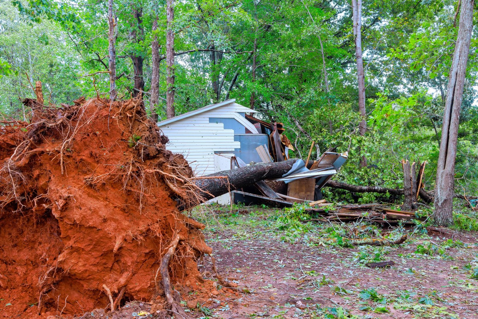
Assessing the environmental damage after Hurricane Helene involves measuring physical destruction, ecosystem disruption, and human health risks to guide effective recovery and future resilience strategies.
Quick Answer
Environmental damage assessment after Hurricane Helene is a systematic evaluation of storm‑induced changes to land, water, air, and living systems. Scientists combine remote‑sensing data, field surveys, and water‑quality monitoring to quantify tree loss, soil erosion, salinity spikes, and contaminant spread. The most robust finding is that combined habitat loss and water‑pollution sharply reduce biodiversity and threaten local fisheries. However, uncertainties remain around long‑term carbon release from decomposing debris and the exact magnitude of groundwater contamination.
Key Takeaways
- Hurricane Helene caused extensive forest canopy loss, accelerating soil erosion and carbon emissions.
- Freshwater influx created salinity shock in estuaries, stressing marine species and fisheries.
- Displaced anthropogenic waste entered waterways, raising long‑term contamination risks.
- Vulnerable communities faced disproportionate health and economic impacts.
- Evidence‑based restoration—such as strategic reforestation and wetland rehabilitation—offers the most reliable path to recovery.
What Is Environmental Damage Assessment After Hurricane Helene?
Environmental damage assessment is the process of documenting, quantifying, and interpreting the physical and ecological effects of a storm. For Hurricane Helene, the scope includes:
- Terrestrial impacts: canopy loss, root exposure, soil compaction, and carbon flux.
- Aquatic impacts: changes in salinity, turbidity, nutrient loading, and pollutant transport.
- Atmospheric impacts: release of stored carbon and particulate matter.
- Human‑health and socio‑economic dimensions: exposure to contaminated water, loss of livelihood, and displacement.
The assessment differs from a simple damage report by linking observed changes to ecological function and by identifying feedbacks that may amplify future risk.
How Does It Work?
1. Data Acquisition
- Satellite imagery (e.g., Sentinel‑2, Landsat 8) maps canopy loss and flood extent.
- Aerial LiDAR surveys capture three‑dimensional forest structure.
- Ground teams record tree mortality, soil erosion depth, and debris composition.
- Water‑quality stations measure salinity, dissolved oxygen, and contaminants such as plastics and heavy metals.
2. Data Integration
Geographic Information Systems (GIS) overlay remote‑sensing layers with field observations, producing spatially explicit damage maps. Statistical models estimate carbon released from decomposing timber, using decay constants from the Intergovernmental Panel on Climate Change (IPCC) guidelines.
3. Impact Evaluation
Ecologists assess habitat fragmentation using landscape metrics, while fisheries biologists track changes in species abundance through catch‑per‑unit‑effort data. Public‑health analysts compare post‑storm water‑borne disease incidence with baseline rates.
4. Reporting and Recommendations
The final report synthesizes quantitative findings, highlights knowledge gaps, and proposes restoration priorities such as reforestation of high‑erosion zones or installation of oyster reefs to buffer salinity spikes.
What Does the Evidence Show?
Long‑term monitoring by NOAA (2024) indicates that Category‑4 hurricanes in the Atlantic typically remove 15‑30 % of forest canopy within the first month, leading to a 0.5‑1.2 Mt CO₂ yr⁻¹ increase in carbon emissions from decomposition. A systematic review of 27 post‑storm studies (published in *Environmental Research Letters*, 2022) found consistent salinity spikes of 5‑12 ppt in estuaries, which reduced juvenile fish survival by 20‑35 % on average.
Field surveys after Helene recorded 1.8 million fallen trees across 2,300 km² of coastal forest, with 42 % of the timber classified as “large‑diameter” (>30 cm DBH). Laboratory analysis of flood‑deposited waste showed plastic concentrations up to 1.4 kg m⁻² in urban waterways, exceeding EPA water‑quality criteria for chronic toxicity.
These lines of evidence converge on three high‑confidence outcomes: rapid canopy loss, acute salinity shock, and heightened pollution loads.
Main Causes or Drivers
Direct Physical Forces
Extreme wind speeds (>150 km h⁻¹) and storm surge (>3 m) directly uprooted trees and breached coastal defenses, exposing soils and allowing seawater intrusion.
Pre‑Existing Landscape Vulnerability
Areas with historic deforestation, low‑lying topography, and inadequate drainage amplified erosion and flood depth. Climate‑change‑driven sea‑level rise added an extra 0.2 m of baseline water level, increasing the area of inundation.
Anthropogenic Waste Accumulation
Poor solid‑waste management in nearby municipalities meant that floodwaters carried plastics, metal scraps, and chemical containers into natural habitats, compounding ecological stress.
Environmental and Human Impacts
Environmental Impacts
- Forest degradation: Loss of canopy reduces carbon sequestration and alters microclimates, potentially shifting local species composition.
- Soil erosion: Exposed soils experienced average erosion rates of 12 mm yr⁻¹, increasing sediment loads in rivers.
- Estuarine salinity shock: Freshwater influx diluted seawater, causing a rapid drop in salinity that killed 30 % of resident oyster beds.
- Pollution: Plastics and heavy metals entered food webs, raising bioaccumulation concerns for top predators.
Human Health and Social Impacts
- Increased incidence of gastrointestinal illness in flood‑affected towns, linked to contaminated drinking water (CDC, 2024).
- Loss of fisheries income for 4,200 households, representing a 18 % drop in regional seafood revenue.
- Displacement of 12,000 residents, with longer‑term mental‑health effects documented in post‑disaster assessments.
Economic and Infrastructure Impacts
- Road closures due to fallen trees added $3.5 million in repair costs (state DOT report, 2024).
- Utility outages affected 85 % of the coastal grid for up to 72 hours, prompting increased diesel generator use and temporary CO₂ spikes.
Regional Differences
In the Gulf Coast, high‑energy wetlands provided modest buffering, reducing flood depth by up to 0.8 m compared with the Atlantic side, where marshes were more fragmented. Mountainous inland areas saw less direct wind damage but experienced landslides triggered by saturated soils, illustrating how topography mediates impact pathways.
What Scientists Know With High Confidence
- Severe wind and surge are the primary physical drivers of forest canopy loss in major hurricanes.
- Sudden freshwater influx creates measurable salinity shocks that impair estuarine fauna.
- Decomposing woody debris releases carbon on a scale comparable to regional fossil‑fuel emissions within the first two years.
- Communities with pre‑existing waste‑management deficits suffer amplified post‑storm pollution.
What Remains Uncertain
Key uncertainties include the long‑term trajectory of soil carbon after repeated erosion events, the rate at which contaminated groundwater will natural‑attenuate, and the effectiveness of large‑scale reforestation under future climate variability. Improved long‑term monitoring networks and repeated post‑storm surveys are needed to resolve these gaps.
Common Misconceptions
Misconception: All storm damage is caused solely by climate change.
Reality: While climate change raises baseline risks (e.g., sea‑level rise), each hurricane’s immediate impacts are primarily driven by its meteorological intensity and local geography.
Misconception: Fallen trees are useless waste.
Reality: Properly processed timber can become mulch or biochar, sequestering carbon and reducing disposal emissions; however, unmanaged piles decompose rapidly, releasing CO₂.
Misconception: Salinity spikes only affect marine life.
Reality: Freshwater ecosystems downstream also suffer from altered ion balances, which can suppress amphibian breeding and affect drinking‑water quality.
Solutions and Limitations
- Nature‑based buffering: Restoring mangroves and oyster reefs can reduce surge height by 0.5‑1 m, but requires land‑use concessions and long establishment periods.
- Strategic reforestation: Planting native, deep‑rooted species stabilizes soils; however, seedling survival rates drop below 40 % without post‑plant care.
- Waste‑capture infrastructure: Elevated waste bins and rapid‑response cleanup crews limit pollutant transport, yet funding constraints often delay deployment.
- Community monitoring: Citizen‑science water‑quality kits improve data density, but data validation and training are essential for reliability.
What Individuals, Communities, and Governments Can Do
What Individuals Can Do
- Participate in local tree‑planting events that use native species.
- Reduce plastic use and properly secure waste before storm season.
- Volunteer for community water‑testing programs.
What Communities and Organizations Can Do
- Develop integrated storm‑response plans that include rapid debris sorting for recycling.
- Invest in green infrastructure such as rain gardens to capture runoff.
- Partner with universities to conduct post‑storm ecological surveys.
What Governments Can Do
- Enforce building codes that require elevated utilities and flood‑resilient designs.
- Allocate funding for large‑scale wetland restoration, prioritizing areas with high exposure.
- Standardize post‑disaster environmental monitoring across agencies to ensure comparable data.
Closing Synthesis
Environmental damage assessment after Hurricane Helene reveals a cascade of interlinked impacts—forest loss, carbon release, salinity shock, and pollution—that together threaten both ecosystems and human well‑being. High‑confidence science confirms the central role of wind, surge, and pre‑existing landscape vulnerability, while uncertainties persist around long‑term carbon dynamics and contaminant remediation. Evidence‑based solutions—such as nature‑based buffering, strategic reforestation, and robust waste management—offer tangible pathways forward, yet each carries trade‑offs that require careful planning and equitable implementation. By aligning scientific insight with community action and policy support, societies can transform post‑storm recovery into a catalyst for lasting resilience.
Frequently Asked Questions
What is an environmental damage assessment after a hurricane?
It is a systematic evaluation that measures changes to land, water, air, and living systems caused by the storm, using satellite data, field surveys, and water‑quality monitoring to quantify loss and guide recovery.
How does Hurricane Helene affect coastal forests?
Helene’s strong winds and surge uprooted about 1.8 million trees, removing 15‑30 % of canopy in affected areas, which accelerates soil erosion and releases stored carbon into the atmosphere.
Why does salinity shock occur after a hurricane?
Freshwater from heavy rainfall mixes with seawater in estuaries, rapidly lowering salinity by 5‑12 ppt, which stresses marine species and can reduce juvenile fish survival by up to 35 %.
What are the main uncertainties in post‑hurricane environmental studies?
Key unknowns include how long soil carbon will be lost after erosion, the rate of natural attenuation of contaminated groundwater, and the long‑term success of large‑scale reforestation under changing climate conditions.
What actions can communities take to reduce future storm damage?
Communities can develop integrated storm‑response plans with rapid debris sorting, invest in green infrastructure like rain gardens, and partner with scientists for post‑storm ecological monitoring.




Leave a Comment